SERVICES
______________________________________
UAVs are an incredibly cost-efficient alternative to traditional onsite inspections, with their quick turnaround and highly efficient data capture capabilities. They can be used for a variety of applications, such as agricultural surveying, architectural mapping, bridge inspections, and pipeline monitoring to name a few. Not only can UAVs provide accurate data from any angle, but they can also take measurements with the use of specialized sensors that allow for detailed analysis of various characteristics such as temperature or elevation. With the use of UAVs, a company is able to quickly collect data on almost any terrain while reducing costs associated with manual inspections. This can include savings in labor costs since site visits are no longer needed and travel expenses are eliminated. UAVs also offer real-time data feedback which means that decisions can be made quickly and more accurately than ever before.
Furthermore, safety risks associated with traditional inspection methods are reduced thanks to the fact that humans don’t need to be on site when conducting an inspection. UAVs are able to fly into areas that may be unsafe or inaccessible for people due to height restrictions or hazardous conditions. Additionally, UAVs have the ability to maneuver around objects and obstacles so that complex inspections requiring various angles can easily be done without having to move personnel from one location to another.
In conclusion, UAV technology has revolutionized the way onsite surveys are conducted with its efficiency, accuracy, cost savings and safety benefits making it an incredibly attractive option for companies looking for fast results at a fraction of the cost of regular inspections.
Thermal Inspection/Mapping
Thermal Imaging and Mapping is growing in importance as a tool for detecting potential issues in a variety of settings. It provides users with an efficient way to identify temperature anomalies and other invisible signs of problems, helping to enhance industrial, agricultural, and wildlife safety. The FLIR XT2 is one such device that helps make thermal imaging and mapping easier, faster and more accurate. It uses sonar with transmission through telecom to transmit data for distribution, allowing for comprehensive inspections and mapping of otherwise hard-to-reach areas. Thermal Inspection and Mapping are vital tools for staying ahead of potential risks in the workplace or out in nature. They help users gain insight into their surroundings that would otherwise be unavailable and make it easier to take preventive measures. Ultimately, Thermal Inspection and Mapping can help save time, money, and lives.
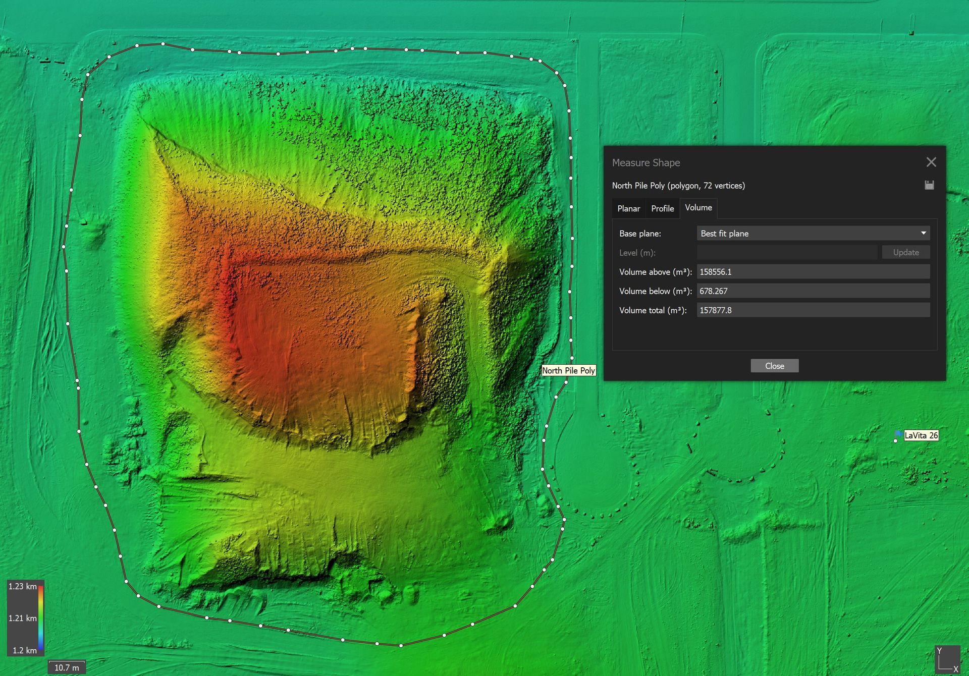
Photogrammetry: RGB & Multispectral
Photogrammetry is a powerful technology used to measure the world around us. Using RGB (Red, Green and Blue) or Multispectral camera systems, survey-grade precision can be attained through the use of Ground Control Points or Post Processing Kinematics (PPK) processing. Our solutions offer sub 2 cm resolution delivering products such as orthomosaics, Digital Terrain Models (DTM) and Digital Elevation Models (DEM) to your exact specification. We also offer 3D Mesh models for a more detailed look at the surveyed area. All results can be integrated with Building Information Modelling (BIM), Computer-Aided Design (CAD) and Geographic Information Systems (GIS) if requested. RGB photogrammetry is suitable for areas with minimal vegetation cover and can be used to detect changes over time or calculate volumetric data. With all of these features, photogrammetry can be a great tool for any surveying job.
LiDar and Visual Inspection
LiDAR imaging offers precise, accurate data for a variety of applications. Its absolute accuracy with ground control and PPK processing makes it ideal for surface reconstruction that take into account vegetation cover. Furthermore, LiDAR imaging can be used to perform change detection and measure volumetric parameters in a given area. Its versatility makes LiDAR the perfect tool for surveying, mapping and monitoring a wide range of environments. With LiDAR, you can ensure maximum accuracy and efficiency in all your data collection tasks. The technology is reliable, efficient and provides valuable insights that would be difficult to obtain without it.
By using LiDAR imaging, you can quickly detect changes in any area and assess the impact of those changes over time. It is also easy to create detailed 3D models that can be used for a variety of purposes, from urban planning to environmental monitoring. Whatever your application may be, LiDAR imaging will help you get the job done with accuracy and precision.
Get in touch today to learn more about how LiDAR imaging can benefit your business and make data collection more efficient. Our team of experts is here to answer any questions you might have and help you get the most out of this powerful technology.
Aerial Utility Work
Aerial Utility Work is the process of utilizing an aircraft to carry specialized payloads such as a magnetometer, ground penetrating radar, and echo sounder. Magenetometers measure the strength and direction of magnetic fields while ground-penetrating radars are used to detect objects buried beneath the surface. Echo sounders can measure water depth by bouncing sound off the seabed. Other external payloads can also be attached to an aircraft while performing aerial utility work.
In addition, Aerial Utility Work involves both short and long line slung loads operations. Short line slung loads consist of products or materials that are attached to a cable or rope that is no longer than 50 feet in length. Long line slung loads consist of products or materials that are attached to a cable or rope that is longer than 50 feet and up to 300 feet in length.
Aerial Utility Work requires specialized training, knowledge of aircraft capabilities and limitations, as well as the skills necessary to safely fly with different payloads attached to the aircraft. With the right training and equipment, aerial utility work is a safe and efficient way to complete many tasks.
Photography
Aerial photography has the potential to be a powerful tool for businesses, in a variety of contexts such as residential, commercial and agricultural. By capturing photos from an aerial perspective, businesses can gain access to invaluable insights about their property and operations that wouldn't otherwise be available. Aerial images provide context and allow you to get a better overview of your site – whether it's a construction or agricultural project, or simply an overview of your business. Whatever the purpose, our aerial Photography services can help you capture stunning imagery for any occasion with high-definition detail. With our help, you can get the perfect shot that you need to showcase your work or location. All images taken are guaranteed to be up to industry standards for quality and clarity, so you can rest assured knowing you’re getting the best services available.
At Wolfe Remote, we understand the potential of aerial photography to provide businesses with unique insights into their operations and can help put it to use. We stay compliant with local laws and regulations, and make sure to capture professional images that detail your work or location. Contact us today to learn more about how aerial photography can benefit your business.
Virtual Tour
Virtual Tours are an excellent way to market and showcase an industry. Whether it’s a real estate agent showing off a new home, or a hospitality business letting customers explore their amenities before arrival, Virtual Tours provide invaluable insights that can help to drive engagement and sales.
Aerial 360° virtual tours give viewers a bird's eye view of the landscape, while interior tours provide a more detailed look at a space. These tours give potential customers the perfect opportunity to learn about a property or business before ever stepping foot inside it. With an interactive tour, viewers can experience all that’s on offer and get to know the layout better than they would through simple photos or videos.
For businesses in the real estate, land development and hospitality industries, virtual tours can be an invaluable tool to drive engagement and sales. By giving potential customers a more immersive experience, they’ll be able to make more informed decisions about whether or not to visit a property or purchase a product.
At Wolfe Remote, we specialize in creating aerial and interior 360° virtual tours that capture the essence of any space. Our tours are designed to give customers an interactive experience, allowing them to explore an area as if they were there. By utilizing our Virtual Tour services, businesses can make their properties more attractive and accessible to potential customers.
Experience the difference a Virtual Tour can make for your business. Contact us today to find out more about our services and get started with a free consultation.
We look forward to working with you!
Progress Monitoring
Progress monitoring with the use of drone remote technology is beneficial for industrial, commercial, and residential construction progress. It can also be used in reclamation and remediation sites to gain insight into land restoration progress by mapping and using multispectral services.
The data collection process is easy with customizable delivery options that are automated and repeatable. This allows users to gather data quickly and accurately, saving time, energy, and money. With the help of drone technology and its remote capabilities, progress monitoring is much easier than it has ever been before.
Overall, progress monitoring with drone technology is a cost-effective solution for all types of construction projects. It provides accurate data that can be easily accessed and used to make decisions. With its customizable delivery options, repeatable data collection, and automated processes, this is one of the best solutions for progress monitoring in the modern world.
Videography
Videography is an incredible medium to capture the beauty and emotion of a moment. As technology progresses, so does the options for videographers to explore different means of creating compelling visuals. From using traditional steadycam rigs to moving shots with drones and gimbals, there are countless ways to capture stunning footage.
For greater creative control, filmmakers may use the First Person View (FPV) technique to create dynamic camera movements. This method allows for a steady camera angle that can be moved around a scene quickly and precisely using either manual control or automated software systems. FPV offers videographers greater control over how they capture their shots while also presenting them with new creative possibilities such as tracking shots and sweeping aerial perspectives.
The smooth 'tripod in the air' feeling of traditional videography has been taken up a notch with the use of drones, allowing for seamless movements between multiple points of view or even around objects. Drone technology has enabled Wolfe Remote to create stunning visuals from an entirely new perspective and it’s become an essential tool for many videographers.
No matter which technique or equipment you use, the possibilities of what can be achieved with modern videography are endless. By combining these techniques, Wolfe Remote can create unique and beautiful visuals that will captivate your audience.
EQUIPMENT
At Wolfe Remote, we understand the importance of having the right drone equipment to get the job done effectively. Our team has assembled a selection of top-of-the-line drones and accessories that can be used for all kinds of amazing applications such as aerial photography, surveying, inspection and more. We have a wide range of options available so that we can find the right drone for your project.
QUANTUM SYSTEMS TRINITY F90+
The Quantum Systems Trinity F90+ is an extended runtime mapper that offers a range of features for professional drone mapping. With its high resolution RGB mapper, users can achieve up to 2 cm resolution imagery. Additionally, it provides multispectral capability with a 10 band MicaSense payload – enabling the capture of physical characteristics such as NDVI and chlorophyll maps. PPK precision is also available with the RGB payload to ensure better accuracy in post-processing. This makes it an ideal choice for surveying, mapping, and other applications that require accurate and high resolution imagery.

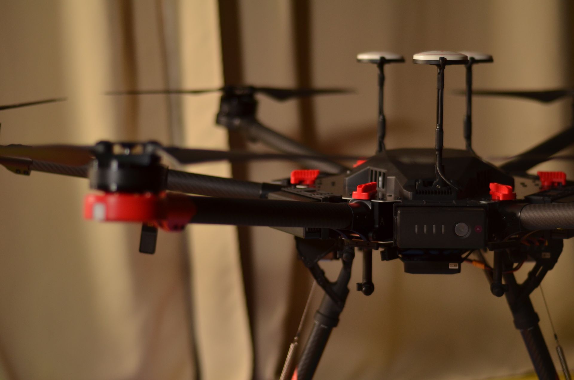
DJI M600
The M600 is the perfect tool for a wide variety of industrial, agricultural and commercial applications. Its 5 kilogram payload capacity allows it to carry heavier loads than other lifters on the market, making it ideal for completing difficult tasks. The long or short line handling capabilities make it suitable for external loads and its specialized sensors, such as magnetometer, GPR, and mid-wave thermal, give it the ability to detect and monitor various areas in its environment.
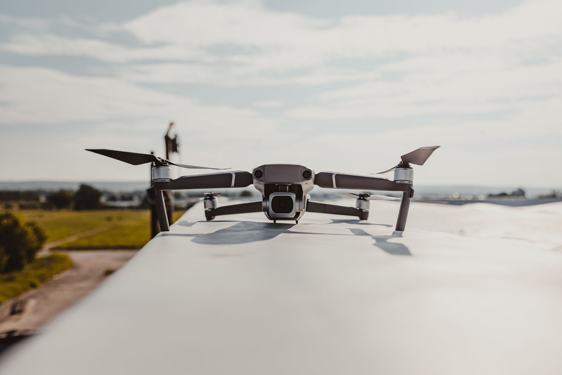
DJI MAVIC 2 PRO
The Mavic 2 Pro is perfect for a variety of uses. It can capture detailed images with its 4K video resolution, making it well-suited for capturing footage of real estate tours or other videos requiring high levels of detail. It also has an adjustable aperture, allowing users to shoot in different lighting conditions and get the results they need. Additionally, it has a range of intelligent flight modes that make capturing footage easier than ever. Its ActiveTrack 2.0 technology can track subjects with ease and its Hyperlapse mode allows users to capture time lapse video quickly and easily. With the Mavic 2 Pro Wolfe Remote can capture your creative vision.
Copyright Wolfe Remote | Proudly powered by Snapps & Advantim Marketing